Project Partner
BNB is equipped with variety of Geophysical, Hydrogeological and Topographical processing and interpretation softwares for the Geological and Geophysical solutions of the customers. These are the latest industrial softwares used for various purposes which enhances the data quality, error reduction and processing capabilities with the provision of the most authentic and reliable results and end products.
| S.NO | DESCRIPTION | PURPOSE |
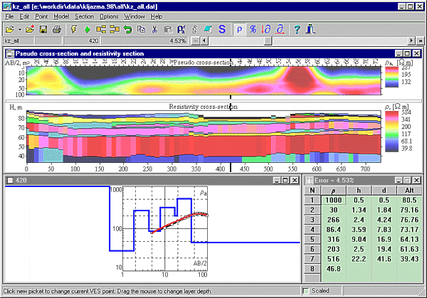
| 1 | IPI2 Win | For attenuation and interpretation of resistivity values |
| 2 | R87 | |
| 3 | Log plot | For designing of formation and geological succession |
| 4 | Rock works | |
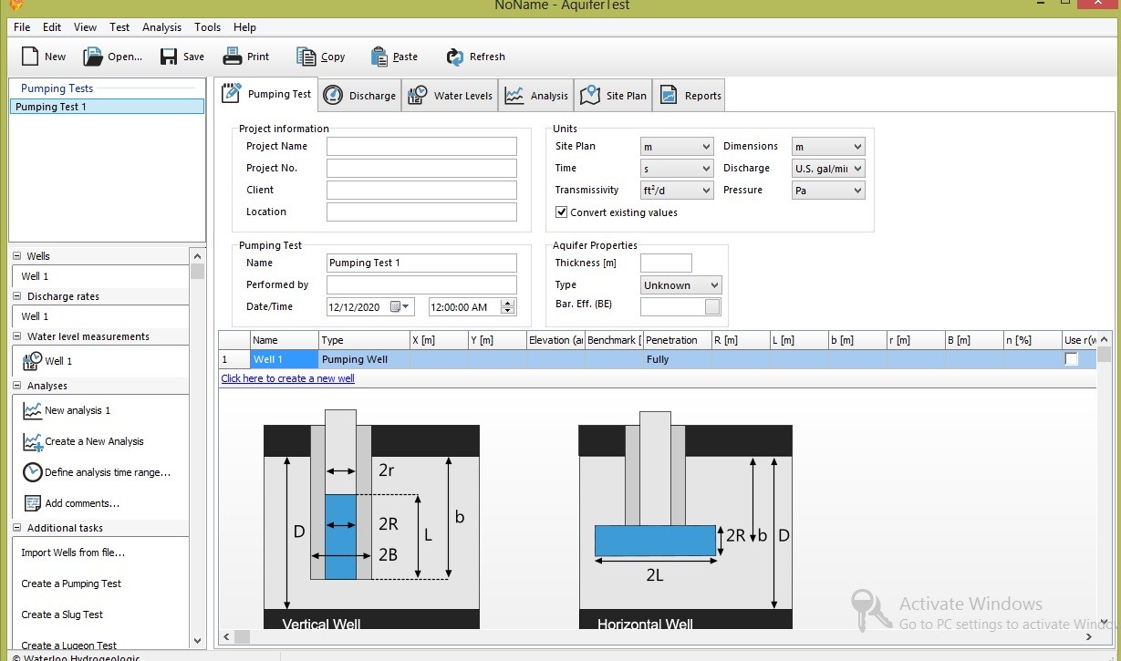
| 5 | Aquifer test pro | Hydrogeological modeling |
| 6 | Mod flow | |
| 7 | Wellvision | For data acquisition of electrical logging |
| 8 | ZondRes 2D |
For 2D subsurface Profiling |
| 9 | Res2Dinv | |
| 9 | Rockware | Tomography |
| 10 | Interseism | Seismic |
| 11 | WellCAD | Well logging |
| S.NO | DESCRIPTION | PURPOSE |
| 1 | AutoCAD 2000 to 2010v | Site Plan |
| 2 | Eagle point 2000 to 209v | 3D Modeling |
| 3 | Mx Road 2005, 2009v | Road Designer |
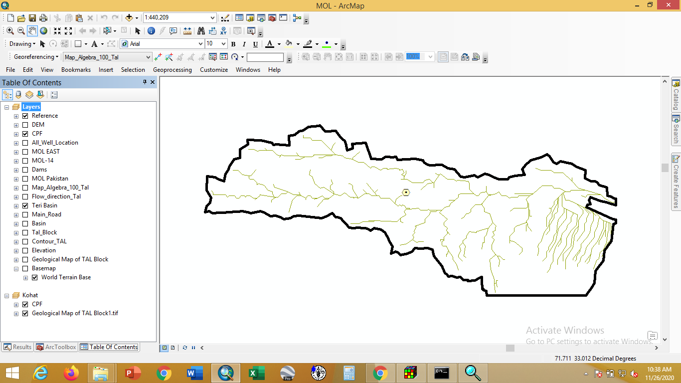
| 4 | Arc GIS 9.0 to 9.3v, 10 | Mapping |
| 5 | Liscad | Survey Design |
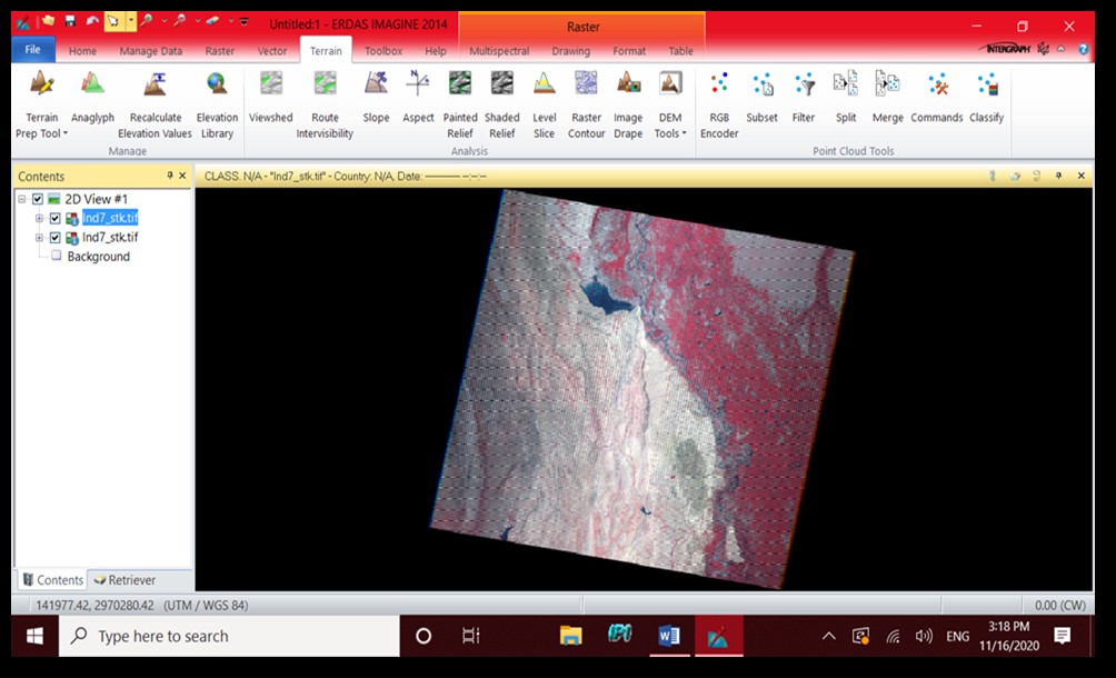
| 6 | ERDAS Imagine | Satellite Image Processing |
| 7 | ECognition | Integrated Software for Remote Sensing |
| 8 | Easy Survey plus | Contouring Purpose |